
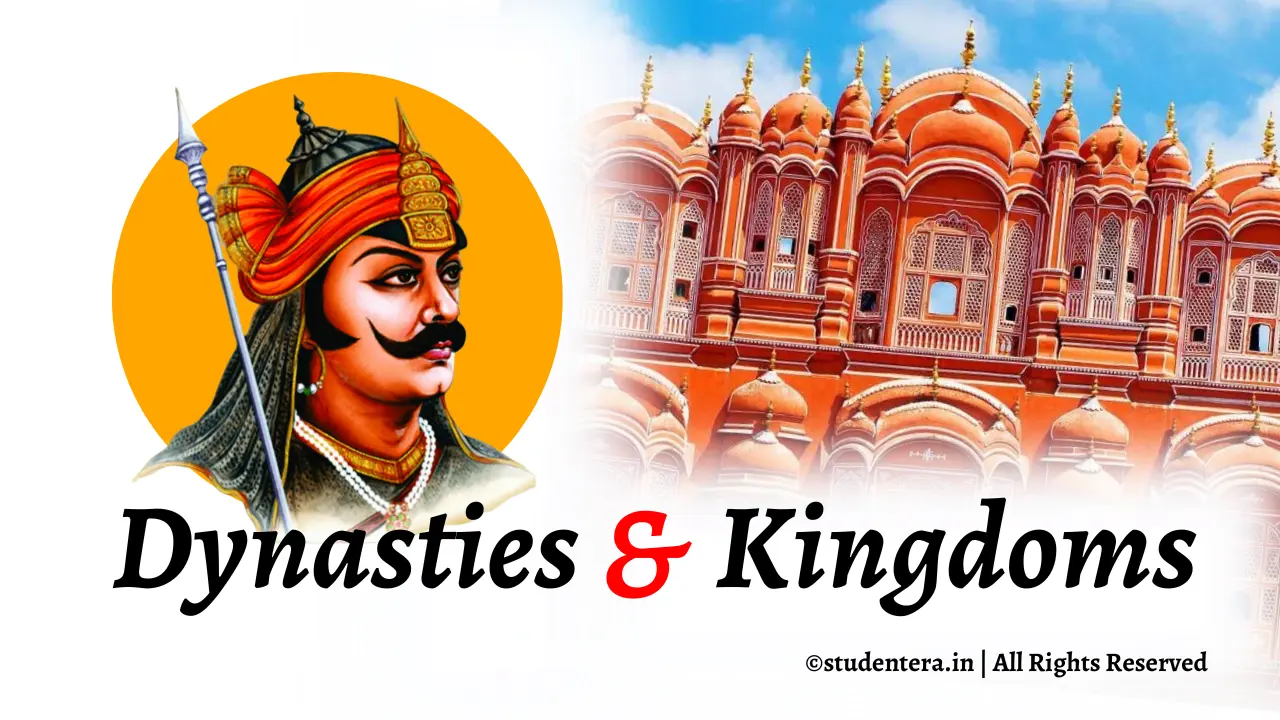
Introduction to Rajasthan
“Rajasthan” means the place of kings, just by hearing its name, you must have realized that this state is rich and prosperous in terms of cultural wealth, devotion and valor.
Rajasthan is the largest state of India in terms of area (after the division of Madhya Pradesh and Chhattisgarh). It is located in the northwestern part of the country.
The glorious tradition of bravery, courage, freedom love and patriotism emerges in the mind on hearing the name of Rajasthan. This state has been the workplace of heroes and famous sages who sacrificed their lives for the motherland. This region boasts of valor stories, examples of bravery and a huge heritage of folk arts.
Rajasthan is a state in northwestern India that is known for its rich cultural heritage, majestic forts, and palaces, and diverse geography. Rajasthan literally means “the land of kings” and it has been home to many powerful dynasties and kingdoms throughout history.
Rajasthan’s culture reflects the amalgamation of various ethnic groups, historical influences, and geographical conditions. In this article, we will explore the history, folklore, and culture of Rajasthan and learn about its ancient and modern cities.
‘Rajasthan’ word and it’s History
This desert dominated region has been called by different names from time to time. Maharishi Valmiki has used the word “Marukantar” for this land. The earliest use of the word Rajasthan was in the Vasantgarh (Sirohi) inscription of “Rajasthaniyaditya” (inscribed in Vikram Samvat 682). After this, the word “Rajasthan” has also been used in the books “Muhnot Nainsi Ri Khyat” and “Rajrupak“.
The word Rajasthan is derived from the Sanskrit term “Rajaputra”, which means “son of a king” or “prince”. This term was used to refer to the Rajput clans that emerged in the region around the 6th century CE.
In the 6th century, Rajput rulers established separate princely states on this Rajasthani land and established their rule. Guhil of Mewar, Rathore of Marwar, Kachwaha of Dhundhar and Chauhans of Ajmer were famous Rajput rulers in these princely states. Due to the predominance of Rajput states, this entire region came to be known as “Rajputana“.
The Rajputs were warriors and rulers who claimed descent from the ancient Kshatriya or warrior caste of Hindu society. They established many kingdoms and principalities in Rajasthan and neighboring areas and resisted the invasions of Muslim rulers from the 11th to the16th centuries. The Rajputs are considered to be the founders of the distinctive culture and identity of Rajasthan.
The word “Rajputana” was first used by George Thomas in 1800 AD for the Rajasthani region. “Colonel James Tod” (Political Agent of the Rajput states of western and central India) called this region “Rāythan“, Because at that time, in local colloquial and secular literature, the residence province of the kings was called “Rāythan“.
During the British period, this province was known as “Rajputana” or “Rajwada” and Ajmer-Merwada (Ajmer and surrounding areas).
Origin of the word ‘Rajasthan’
The first use of the word “Rajasthan” for this geographical area was made by “Colonel James Tod” in his famous historical work “Annals and Antiquities of Rajasthan” published from London in 1829 on the history of Rajasthan (book’s other name is central and western Rajput states of India).
After different nomenclature during the process of state reorganization after independence, finally on January 26, 1950, the name of this entire geographical region was formally accepted as “Rajasthan”, then Ajmer-Merwada region was not included in it.
Popular names of various princely states and units of Rajasthan
Jangaldesh
”Jangladesh/Jangalpradesh means the country of the forest“
| Item | Value |
|---|---|
| Geographical Region | Northern Rajasthan |
| Establishment of Jangaldesh | 4th – 25th century BC |
| Languages and dialects | Mewari, Marwari, Jaipuri and Malvi etc. |
| Ruling Dynasty | Jaat (originated from Dhangar dynasty) |
Jangaldesh (Rajasthan), which is also known by the name of Jangalpradesh, was a historical state of north-west and north-east Rajasthan state in northern India. Present Bikaner, Ganganagar, Anupgarh and Hanumangarh districts were included in this.
It was a Jaat kingdom surrounded by Marwar and Jaisalmer regions in the south, Ajmer-Merwara region in the east. The mention of this province is found in the Bhishmaparva of the Mahabharata.
Yoddheya
“The word Yoddheya is derived from the word Yoddha, Yoddha meaning warrior.“
| Item | Value |
|---|---|
| Geographical Region | Northern Rajasthan |
| Reign | 5th century BCE – 4th century CE |
Yoddheya or yoddha (Yoddheya ganarajya), It was an ancient militant organization. It was a Maurya Empire, and included Ganganagar, Anupgarh and Hanumangarh districts of the present Rajasthan state.
This was the name given to the region in the south-eastern part of Rajasthan that was ruled by the Yoddhas, a warrior clan that claimed descent from Lord Rama. The Yoddhas were also known as the Suryavanshi Rajputs and they founded the kingdom of Karauli.
Shoorsen
| Item | Value |
|---|---|
| Ruler | Yaduvanshi |
| Reign | around 600-700 BC |
Shoorsen Janpad was located in Rajasthan, the northern part of Bharatvarsh, in ancient times, in ancient times, there were many units united in the state, which used to be different from each other, for example, the northern part of Jaipur state was part of Madhyadesha and the southern part was known as Sapaldaksha.
The northern part of Alwar state was called Kurukshetra and Bharatpur, Dholpur, Karauli states were included in Shursen country.
This region was probably named by Shatrughan after killing Lavanasura, the ruler of Mathurapuri (Mathura), Shatrughna named this region with his son’s name Shoorsen.
King Shursen established a new city in place of old Mathura, which is described in the Uttarakand of Valmiki Ramayana. “The Mahabharata mentions the victory of Sahdev over Shursen district.“
In the Vishnu-Purana, the inhabitants of Shursen are probably called Shurs and they are mentioned after the Abhiras.
This was the name given to the region in the eastern part of Rajasthan that was ruled by the Shoorsenas, a clan that claimed descent from Lord Krishna. The Shoorsenas were also known as the Yaduvanshi Rajputs and they founded the kingdom of Jaipur.
Girwa
This was the name given to the region in the southern part of Rajasthan that was ruled by the Guhilas, a clan that claimed descent from the fire god Agni. The Guhilas were also known as the Sisodia Rajputs and they founded the kingdom of Mewar, which was the most powerful and prestigious Rajput kingdom.
The capital of Mewar was Udaipur, which is also known as the City of Lakes.
Godwad
| Item | Value |
|---|---|
| Ruler | This is the only region of Rajasthan where there has been a majority of Rajput rulers. |
| Geographical Region | It extends from Aravalli mountain to Jalore-Sirohi in south east and south west. |
The Rajput rulers who ruled Godwad Region:
| Clan | Ruling Kings |
|---|---|
| Rathore | Medtiya, Jaitmalot, Champawat, Jodha, Koompawat, Sindhal, Bala, Roopawat, Ridmatol, Vairawat and Udawat |
| Chouhan | Sanchaura, Sonigara, Kheenchee, Balecha and Madrecha |
| Kachhwaha | Rajawat and Shekhawat |
| Sisodiya | Ranawat, Shaktawat, Keetawat, Mangalia and Bhakharot |
| Solanki | Raankash etc. |
”Sanderao” is called the “Gateway” of Godwad, it includes – “Pali District, Pratapgarh Sadri, Bali Rajasthan and Rani Rajasthan, Desuri and Sumerpur tehsil” was earlier under the control of Mewar region.
But later on, King Vijay Singh of Marwad captured it after seeing the opportunity during the civil war in Mewad.
After the victory over Desuri, Thakur of Ghanerao place was called “Godwad” and the king was addressed as “Sarkar”.
Here in the form of main thickets of “Godwada”, Ghanerav, Beda, Nana, Varkana, Phalna, Chanod, Narlai, Boya, Devali Pabuji, Beejapur, Saanderav, Malari, Beesalpur, Galathani, Koleewada, Pawa, Kanvala etc.
Godwad has been recording its presence in history since ancient times, Desuri Pass was the only way to reach Mewar, Maharana of Mewad had given the responsibility of protecting this area and route to Solanki and Medatiya Rajputs.
Aurangzeb, the emperor of Delhi, attacked Mewad, than Desuri’s Vikram Solanki and Ghanerao’s Himmat Medtiya defeated the Aurangzeb, in this case a marwadi proverb is famous, “बादशाह री पाग हिम्मत बिके उतारी” That is, emperor Aurangzeb’s “पाग” meaning turban, which is the honor of a person, was removed (उतारी) by “हिम्मत” meaning Himmat Singh Medtia and “बिके” meaning Bikram Singh Solanki, meaning Aurangzeb’s honor was mixed with the soil by these two knights.
Before the arrival of Rajputs, this area was under “Gond” Meena tribe, that is why this area was known as “Godwad”. Later, after the removal of the Meenas, the Rajputs established their supremacy and pushed the native Meenas aside. That’s why the chieftains of Meena caste living here always used to terrorize Mewar.
Ahichhatrapur
The ancient or old name of present Nagaur was “Ahichhatrapur“, meaning the area around Nagaur was once known as Ahichhatrapur.
This was the name given to the region in the northern part of Rajasthan that was ruled by the Ahirs, a pastoral and cattle-rearing community.
The Ahirs were also known as the Chauhan Rajputs and they founded the kingdom of Ajmer, which was the first Rajput kingdom to be established in Rajasthan.
Ajmer was also the seat of the famous Sufi saint Khwaja Moinuddin Chishti, whose shrine attracts millions of pilgrims every year.
Raath
The area of Alwar district bordering Haryana was later known as “Raath“. Some people of Haryana use the word “Rathee” in their surname because of this area.
There is also a popular breed of cows here which is known as “Rathee“.
There is a famous proverb about “Raath”, “ना राठ नवै, ना राठ मनै” Means “राठ” neither bows down by bowing down nor convinces by requesting, “राठ” simply does as per its wish.
Uparmal
This was the name given to the region in the western part of Rajasthan that was ruled by the Uparmals, a clan that claimed descent from the sage Vashishta.
The Uparmals were also known as the Kachwaha Rajputs and they founded the kingdom of Amber, which later became Jaipur.
Amber is famous for its hilltop fort and palace, which are examples of Rajput architecture.
The plateau part of Bhilwara and Chittorgarh, which was known as the stone of “Uparmal” in ancient times.
- “Dakkan lava” Plateau is also known as “Paathar” or “Uparmal” Plateau.
- It is a broad and rocky terrain including Kota-Bundi.
- The tributaries of “Chambal River” “Kali Sindh” and “Parvati River” form a triangular alluvial valley of 210 meters to 275 meters in Kota, and mostly black soil is found in this region.
Kanthal/Devaliya
This was the name given to the region in the central part of Rajasthan that was ruled by the Kanthals, a clan that claimed descent from the serpent god Vasuki.
The Kanthals were also known as the Deora Rajputs and they founded the kingdom of Sirohi, which was also known as Devaliya.
Sirohi is famous for its temples and forts, which are examples of Jain and Hindu architecture.
Pratapgarh and the surrounding area was known as Kanthal or Devaliya.
In ancient times it was known as “Kanthal-Raj”. The literal meaning of “Kanthal” is – “Kantha-Pradesh” or the land of the coast.
Shekhavati
This was the name given to the region in the north-eastern part of Rajasthan that was ruled by the Shekhawats, a clan that claimed descent from the legendary king Shekha.
The Shekhawats were also known as the Shekhawati Rajputs and they founded the kingdom of Shekhawati, which was also known as the Land of Havelis.
Shekhawati is famous for its painted havelis, which are decorated with frescoes depicting scenes from history, mythology, and everyday life.
| Item | Value |
|---|---|
| Geographical Region | Northern Rajasthan |
| Establishment of Shekhwati state | 1445 AD |
| Language/Dialect | Shekhawati |
| Dynasty | Shekhawat (branch of the Kachhawaha dynasty of Jaipur) |
| Historical Capitals | Amarsar, Shahpura, Sikar, Lamia and Jhunjhunu |
| The places of Shekhwati | Godiawas, Lamia, Khandela, Khatu, Khud, Sikar, Kankadu, Kalan, Patalis, Panchpana, Khetri, Danta and Dholakheda etc. |
Ajmer-Merwada
This name was given to the region in the eastern part of Rajasthan that was ruled by the Merwadas, a clan that claimed descent from the sage Meru.
The Merwadas were also known as the Pratihara Rajputs and they founded the kingdom of Ajmer-Merwada, which was also known as the Land of Pratiharas.
Ajmer-Merwada was the most powerful Rajput kingdom in the 9th and 10th centuries and it acted as a barrier for the Arab invaders from Sindh.
Diver area of Ajmer and Rajsamand district is known as “Merwada“.
Ajmer-Merwada during Indo-British Empire
- Ceded to the Indo-British Empire – 1818 AD
- Merger of Central Provinces and Berar Provinces – 1936 AD
- Area – as per 1881 AD area was 7021km² (2711 square miles)
- Population – 4,60,722 people in 1881 AD
- Population density (in 1881AD) – 65.6/km² (170/square miles)
| Item | Value |
|---|---|
| Ceded to the Indo-British Empire | 1818 AD |
| Merger of Central Provinces and Berar Provinces | 1936 AD |
| Area | as per 1881 AD area was 7021km² (2711 square miles) |
| Population | 4,60,722 people in 1881 AD |
| Population density (in 1881 AD) | 65.6/km² (170/square miles) |
Dhundhad (Dhundhaar)
| Geographical Region | East-central Rajasthan |
This was the name given to the region in the eastern part of Rajasthan that was ruled by the Dhundhads, a clan that claimed descent from the sage Dhundhu.
Dhundhad (which can also be called Jaipur region) has been a historical region of Rajasthan state, It has also been called Kachwaha State, Amber State and Jaipur State from time to time.
Dhundhaar was the original name of Jaipur, which was founded by Maharaja Sawai Jai Singh II in 1727.
This region is covered by the Arawali Parwat Mala in the north-west, Ajmer in the west, Mewad in the south-west, Hadoti and Alwar district in the south and Karauli and Bharatpur district in the east.
Districts included in Dhundhad –
- Jaipur
- Dausa
- Sawai Madhopur
- Tonk
- Northern Part of Karauli District
Vagad/Vagvar
| Item | Value |
|---|---|
| Country | India |
| State/Province | Rajasthan |
| Districts | Banswara and Dungarpur districts |
| Languages spoken | Bagadi and Hindi |
This was the name given to the region in the southern part of Rajasthan that was ruled by the Vagads, a clan that claimed descent from the sage Vagad. The Vagads were also known as the Solanki Rajputs and they founded the kingdom of Vagad, which was also known as the Land of Solankis.
Vagad was famous for its temples and sculptures, which are examples of Solanki style of art.
In the southern part of Rajasthan state, Between Gujarat and Madhyapradesh states have one region. Currently, it is located in Banswara and Dungarpur districts. The local language here is Bagdi, it is located in the “Jalsambhar” above the Mahi river.
Marwad
Let us know about the historical region “Marwad” of North India…
| Item | Value |
|---|---|
| Geographical Region | Western Rajasthan |
| Establishment of Rajasthan | 6th Century |
| Language/Dialect | Marwadi |
| Dynasty | Parihar (Pratihara) dynasty (6th to 13th century), Rathore (1226-1949 AD) |
| Historical Capital | Mandor, Jodhpur |
”Marwad” is located partly in the Thar Desert in the west of the Rajasthan state. The word Marwar is derived from the Sanskrit word “Maruwat“. “Maruwat” literally means the land of death. In ancient times “Marwar” was also known as “Marupradesh”.
The districts of Jodhpur, Phalodi, Pali, Balotra, Barmer, Jalore, Sanchore and Nagaur etc. come under the “Marwad” state.
[Marwad] Word’s meaning – In “Marwad” word “wad” means “defense” and “Maru” means “desert“, so the meaning of “marwad” is, “A country protected by desert“.
Aarbud/Chandravati
| item | Value |
|---|---|
| Geographical Region | South-west Rajasthan |
| District | Sirohi district |
| Popular languages | Rajasthani/Marwadi |
| Tehsil | Aabu Road |
”Chandravati” is a village situated on the West Banas River in Sirohi district in the south-western part of the State of Rajasthan, India, it used to be an important city in ancient history. Even today, ancient temples, pylons and statues and their remains have been found throughout the area.
Mewal
The land between Dungarpur and Banswara was called “Mewal“. Most of the people here are Meenas (tribal caste).
Mewat
Mainly Alwar and its surrounding area is called “Mewat“. It also shares a border with Haryana. It corresponds to “Matsya Pradesh“, which was founded in the 5th century BC.
Torawati
“The flow area of kantali river in Shekhawati is called Torawati“.
Torawati was initially dominated by the Tanwar (Tomar) dynasty rulers.
Bangad (Bangar)
Pali, Nagaur, Sikar and parts of Jhunjhunu which are the runoff areas of the Luni river, and the tribal region of the Aravali Mountains were collectively known as “Bangad“.
Plateau region of Bhorat
The plateau region of Bhorat includes Gogunda of Udaipur district and Kumbhalgarh tehsil of Rajsamand.
Kherar and MalKherad
Jahajpur tehsil of Bhilwara district and most part of Tonk district is known as “Kherar” and “Malkherad“.
Matsya state
Matsya was one of the 16 Mahajanapadas, in which the collective lands of Alwar, Bharatpur, Dholpur and Karauli districts were known as “Matsya Pradesh“. It existed since the Mahabharata period. There used to be “Matsya” people living here, who are today called Meenas.
Mewad
The region of Udaipur and Chittorgarh in the south-central of Rajasthan state is known as Shivi, Medpat and Mewar (this area was also called Pragavat in ancient times). This state was ruled by the Guhil and Sisodia kings.
Maal
The south-eastern plateau region of Rajasthan was known as “Maal” in ancient times, most of it is also located in Rajasthan’s neighboring state of Uttar Pradesh.
Salva state
Alwar and surrounding areas were known as “Salva Pradesh” in ancient times.
Maalani
Barmer and Jalore are also known as “Maalani“. The old name of Barmer was “Maalani“.
Even now, Indian Railways runs a train called “Maalani Express“.
Hadoti region
“Hadoti has been a historical region of North India“
| Item | Value |
|---|---|
| Geographical Region | Eastern Rajasthan |
| Dynasty | Hada Rajput |
| Language | Hadoti |
| Establishment of state | in the 12th century |
| Historical Capital | Bundi, Rajasthan |
| Main River | Chambal river (Supporting river – Kali Sindh, Parvati river, Parvan and Chapi river) |
| Soil | Alluvial soil |
It has been a historical region of India located in eastern Rajasthan, at present Kota and Bundi are its two major cities.
The districts of this region at present time –
- Bundi
- Kota
- Bara
- Jhalawar
Mewar state in the west of Hadoti region, Ajmer in the north-west and Malwa and Gird region in the south and east respectively.
Bhomat Area
Dungarpur East Sirohi and Udaipur district were included in “Bhomat area“.
It’s also called “Bhoomat Area“.
| Item | Value |
|---|---|
| Area | 1233 |
| Rivers | Sabarmati and Vakal River |
The Bheel movement was prominent in the Bhomat area, which was run by Motilal Tejawat to bring awareness in the society, it is also known as the “Eki movement”.
Kuru state
The Kuru kingdom was a famous kingdom known in ancient India for military might, strategy along the banks of the Ganges River, and for fans of Vedic learning and school.
The Kuru dynasty, which was founded by King Bharata, played a significant role in shaping the political, cultural and religious outlook of ancient India.
The story of a great battle fought between the two fils told in the Mahabharata has emerged as an important fact of the Kuru country and is one of the popular stories in Rajasthan and other regions.
Thali (Northern Desert land)
Most part of Bikaner, Churu and the desert of southern Ganganagar is known as “Thali” (meaning deserted land area).
Malav state
The Malwa region of India is located to the east of Rajasthan and shares its border with the southern districts of Kota, Baran, and Jhalawar. It has a rich history dating back to ancient times and was ruled by various dynasties, including the Mauryas, Guptas, Paramaras, Mughals, and Marathas. The Parmars, who ruled from Dhar, were among the most powerful and influential dynasties in the region.
Dang region
Some parts of Dholpur, Karauli and Sawai Madhopur were known as “Dang Region“.
Meru
Aravalli mountain region was known as “Meru“.
Gurjaratra
The southern part of Jodhpur (Mandore) which is also known as Gurjaratra.
Deshahro
The literal meaning of word in Marwadi is “Deshharo” is the green country.
The hilly area between Jarga (Udaipur) and Raga (Sirohi) mountains is known as “Deshahro“.
This area is always green due to being in the middle of the hills, hence it is known as “Deshahro”.
Major Dynasties and their Kingdoms in Rajasthan
| Dynasty | Kingdom |
|---|---|
| Pratihar | Mandor, Bheenmal, Jalor and Gurjaratra |
| Kachhwaha | Jaipur, Alwar |
| Guhil | Mewad, Banswara, Dungarpur, Udaipur, Chittorgarh |
| Sisodiya | Udaipur, Chittorgarh, Shahpura, Pratapgarh, Dungarpur and Banswara |
| Chauhan | Ajmer, Jalor, Sivana, Bundi, Sirohi, Kota, Ranthambore, Nadaul and Gagron |
| Yadav | Karauli, Jaisalmer, Hanumangarh |
| Rathore | Jodhpur, Kishangarh, Bikaner |
| Bhati | Jaisalmer, Hanumangarh |
| Parmar | Abu, Kiradu, Malwa, Vagad, Jalor |
| Jhala | Jhalawar |
| Hada Chauhan | Kota, Bundi |
| Jaat | Bharatpur and Dhaulpur |
| Muslim | Tonk |
| Devda Chauhan | Jalor |
| Kheenchee Chauhan | Gagron |
| Chavda | Bheenmal |
Present names of ancient cities of Rajasthan
| Ancient Cities | Present Name |
|---|---|
| Ajaymeru | Ajmer |
| Kaanthal | Pratapgarh |
| Shreepanth | Banaya |
| Khijrabad | Chittorgarh |
| Virat | Bairath |
| Jainagar | Jaipur |
| Maadhyamika | Nagari, Chittorgarh |
| Ramnagar | Ganganagar |
| Aalaur | Alwar |
| Chandravati | Sirohi |
| Tamravati Nagari | आहड़ |
| Jabaliipur | Jalor |
| Gopal Pal | Karauli |
| Kothi | Dhaulpur |
| Shakambhari /Sapaldaksha | Sambhar and surrounding area |
| Konkan teerth | Pushkar |
| Maand | Jaisalmer |
| Satyapur | Sanchor |
| Bhatner | Hanumangarh |
| Ahichhatrapur | Nagaur |
| Shreemal | Bheenmal |
| Upkesh Pattan | Osia |
| Braj Nagar | Jhalarapatan |
| मालाणी | Barmer |
Frequently Asked Questions (FAQs)
What is the old and ancient name of Jaisalmer?
Jaisalmer was primarly known as “Maand” in ancient time.
What is the old and ancient name of Barmer?
This area was known as Mallani in the 12th century. Its present name was given by its founder Bahada Rao, popularly known as Parmar ruler (Juna Barmer) Bar Rao. He established a small town which is presently known as “Juna” which is 25 kms away from the present city of Barmer.
What is old or ancient name of Rajasthan?
Due to the predominance of Rajput states, this entire region came to be known as “Rajputana”. The word “Rajputana” was first used by George Thomas in 1800 AD for the Rajasthani region.
Which dynasty ruled Jaisalmer?
Rawal Jaisal founded the region and built a fort using yellow stones (which makes it golden, Jaisalmer is called the Golden City because of its yellow stones), and later the Bhati dynasty ruled the region, Which is presently known as “Jaisalmer”.
What is a “Plateau”?
A plateau is a flat, elevated landform that is steep height from at least one side

Nice information, It’s helpful.
Nice information, It’s helpful.
Waiting for next article, nice study material!
New article is out now go and checkout –> New Article
Waiting for next article, nice study material!
New article is out now go and checkout –> New Article
This is really helpful study material.
This is really helpful study material.